Welcome to DU!
The truly grassroots left-of-center political community where regular people, not algorithms, drive the discussions and set the standards.
Join the community:
Create a free account
Support DU (and get rid of ads!):
Become a Star Member
Latest Breaking News
Editorials & Other Articles
General Discussion
The DU Lounge
All Forums
Issue Forums
Culture Forums
Alliance Forums
Region Forums
Support Forums
Help & Search
Anthropology
Related: About this forumThis ancient Maya city may have helped the Snake King dynasty spread
Lidar maps and hieroglyphics suggest La Corona wasn’t so isolated after all
BY BRUCE BOWER 2:00PM, APRIL 17, 2018

MAYA HUB An ancient Maya site called La Corona (shown in this artist’s illustration with a ceremonial center in the foreground) was a remote but key part of a large Classic Maya state, new research suggests.
PACUNAM
WASHINGTON — New insights into an ancient Maya kingdom are coming from a remote outpost in the Guatemalan jungle.
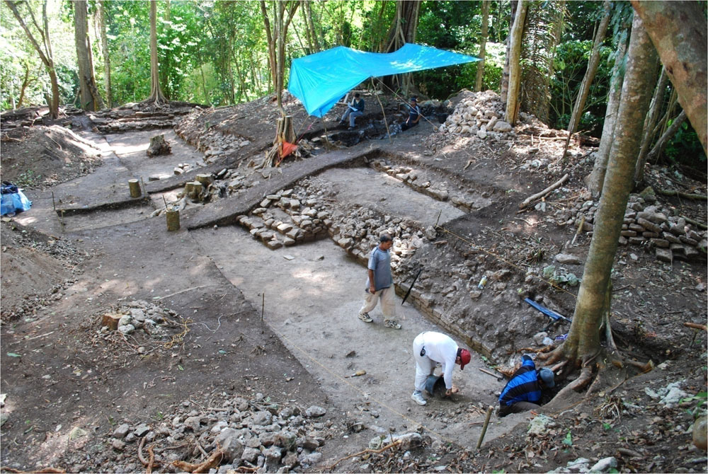
Aerial laser maps, excavations and stone-slab hieroglyphics indicate that La Corona, a largely rural settlement, became a key part of a far-ranging Classic-era Maya kingdom that incorporated sites from southern Mexico to Central America, researchers reported on April 15 at the annual meeting of the Society for American Archaeology. Classic Maya civilization lasted from around 250 to 900.
A dynasty of Kaanul rulers, also called Snake Kings, expanded their domain from their home city of Calakmul in Mexico by using La Corona as a relay center for precious stones and other goods from Kaanul-controlled sites farther south, said archaeologist Marcello Canuto.
“Our work supports the idea that the ancient Maya formed interconnected political systems, not largely separate city-states as traditionally thought,” said Canuto, of Tulane University in New Orleans, who codirects the La Corona excavation.
More:
https://www.sciencenews.org/article/ancient-maya-city-snake-king-dynasty-la-corona-archaeology
InfoView thread info, including edit history
TrashPut this thread in your Trash Can (My DU » Trash Can)
BookmarkAdd this thread to your Bookmarks (My DU » Bookmarks)
1 replies, 1442 views
ShareGet links to this post and/or share on social media
AlertAlert this post for a rule violation
PowersThere are no powers you can use on this post
EditCannot edit other people's posts
ReplyReply to this post
EditCannot edit other people's posts
Rec (2)
ReplyReply to this post
1 replies
 = new reply since forum marked as read
Highlight:
NoneDon't highlight anything
5 newestHighlight 5 most recent replies
This ancient Maya city may have helped the Snake King dynasty spread (Original Post)
Judi Lynn
Apr 2018
OP
Judi Lynn
(162,385 posts)1. Lasers in the Jungle
Volume 63 Number 4, July/August 2010
by Arlen F. Chase, Diane Z. Chase, and John F. Weishampel
Airborne sensors reveal a vast Maya landscape

Caracol has been studied and excavated for 25 years, but just a few weeks of LiDAR work created a detailed map of 80 square miles of the site—nearly eight times the area that had been previously mapped from the ground. (Courtesy Arlen Chase)
Even when one is almost directly on top of them, many Maya sites are impossible to see. In the jungle, small palms and brush can spring to 14 feet high in a year, filling the space between towering cedar, mahogany, ramon, and ceiba trees. When we can find large Maya sites, we cannot easily map them because it is expensive and labor-intensive. Even modern electronic distance meters have limited functionality; if we can't see through the trees, neither can they. So we cut paths with machetes, scramble through thick underbrush, and wonder what we might be missing. The ability to see through this dense, steamy jungle has long been the dream of Maya archaeologists.

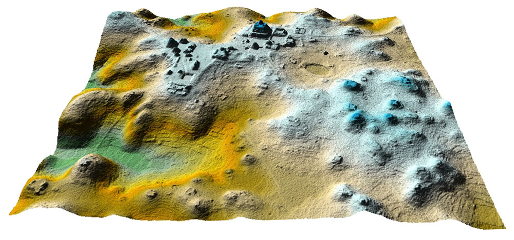
Airborne laser-scanning technology, called LiDAR, provides a 3-D map of part of the Maya city at Caracol in Belize. LiDAR cuts through the jungle to reveal the hidden features beneath--a revolution in the study of ancient Maya landscapes. (Courtesy Arlen Chase)
These difficulties have led us to underestimate the accomplishments and ingenuity of the ancient Maya. There is little agreement among archaeologists over just how big some Maya cities were, how many people lived in them, or how intensively their residents modified the landscape. It often appears that sites in more easily studied areas of the world—plains, sparse forests, or areas cleared in modern times—are larger and more complex than their tropical forest counterparts. Does this impression reflect the inability of ancient humans to create large, sustainable settlements in the tropics, or is it the result of incomplete investigations, hampered by the complications of working in a rainforest?

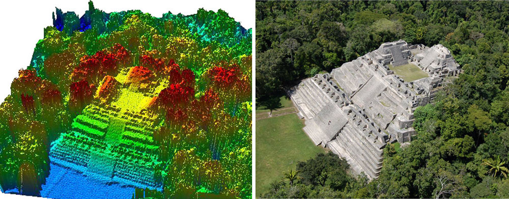
A LiDAR image of the Caana complex at the heart of Caracol, at left, shows the tree canopy surrounding a 140-foot-tall building (in an aerial photo at right). The lasers also penetrate the jungle to reveal structures hidden by that overgrowth. (Courtesy Arlen Chase)
These difficulties have led us to underestimate the accomplishments and ingenuity of the ancient Maya. There is little agreement among archaeologists over just how big some Maya cities were, how many people lived in them, or how intensively their residents modified the landscape. It often appears that sites in more easily studied areas of the world—plains, sparse forests, or areas cleared in modern times—are larger and more complex than their tropical forest counterparts. Does this impression reflect the inability of ancient humans to create large, sustainable settlements in the tropics, or is it the result of incomplete investigations, hampered by the complications of working in a rainforest?
More:
https://archive.archaeology.org/1007/etc/caracol.html